
Brush
Control
Rangeland, pasture, backyard.
Don’t let brush control your property.
Huisache, mesquite, yaupon, black brush, white brush, rose hedge, green brier, chinese tallow, etc.
While we believe that every plant has its place, some species are invasive and interfere with our activities and businesses.
We will work with you in order to come up with a brush control plan that finds the right balance between work, play, nature, and the local wildlife. With the precision of aerial drone application it doesn’t have to be all or nothing.
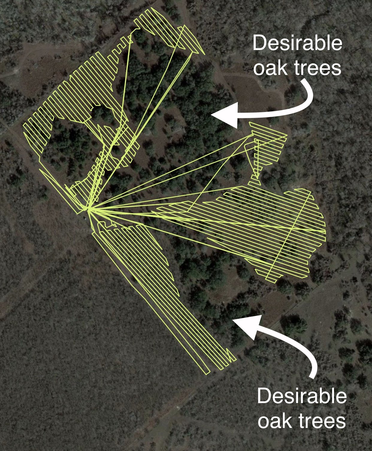
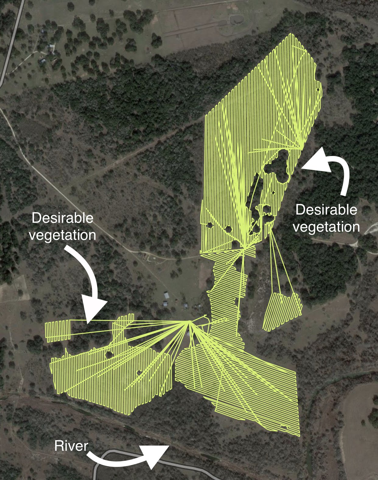
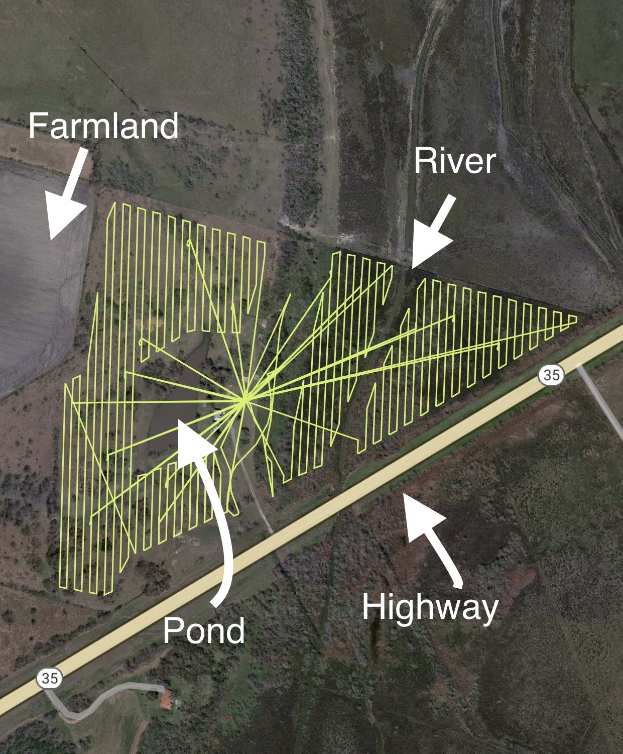
Our drones are capable of delivering precise amounts of liquid or dry herbicide to targeted areas.
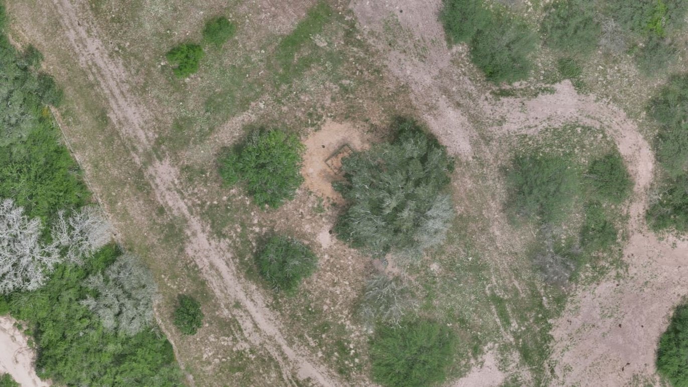
Below are some examples of the drone’s flight patterns to emphasize the level of precision and complexity that can be carried out.
Keep it up.
We also offer mapping services so you can keep up with the constant changes to your property, and build a historic database that will help you plan for the future.
Unlike satellite images, drone imagery is much higher resolution and, most importantly, it’s current! Most satellite imagery only gets updated every few months in remote locations.
Below is the most recent of a Google satellite image taken in January of 2023, compared to a drone shot of the same area taken in April of 2024.

Getting started
Timing for brush control is the most crucial part of maintaining control. Get in touch with us today to start planning.
Head on over to the Contact Us page.